Sextant Navigation
Everybody relies on GPS these days; it’s precise and convenient. But perhaps we shouldn’t take it as granted? The GPSJam map shows a wide red area across the Baltic. A sextant, a watch, and a current almanac might not be that antiquated, actually.

The harbour of Stavoren.
But celestial navigation is a perishable skill. The only way to get better is to take sights, reduce them, and compare against a known position. The simplest and most reliable observation in celestial navigation is the noon sight.1 When the sun crosses the local meridian it reaches its highest altitude. Latitude falls out directly: Lat = Dec ± (90° − Ho), where the sign depends on whether the sun’s geographical position is north or south of the observer.
Sun sights taken before or after meridian passage need more calculation, making it difficult to learn and improve by repeated sextant sights. To focus on the practical side of sextant navigation rather than on the bookkeeping, I wrote a small browser app that gives immediate feedback. From the sextant altitude, the time of observation, and an assumed position, it computes the observed altitude (Ho), the calculated altitude (Hc), the intercept distance, and the azimuth using the same mathematics as manual sight reduction. The method is the altitude-intercept procedure first published by Marcq de Saint-Hilaire in 1875.2 The line of position is drawn on a map and compared against the device’s GPS. You can take ten sights in succession and watch your bias shrink as you correct it. The app lives at sailorslog.io/intercept.
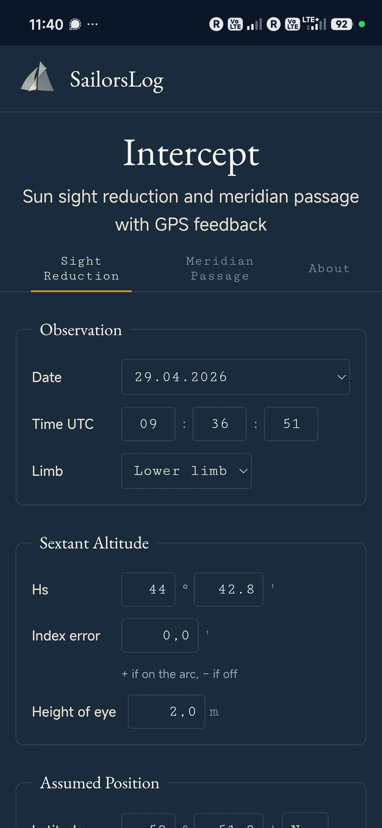
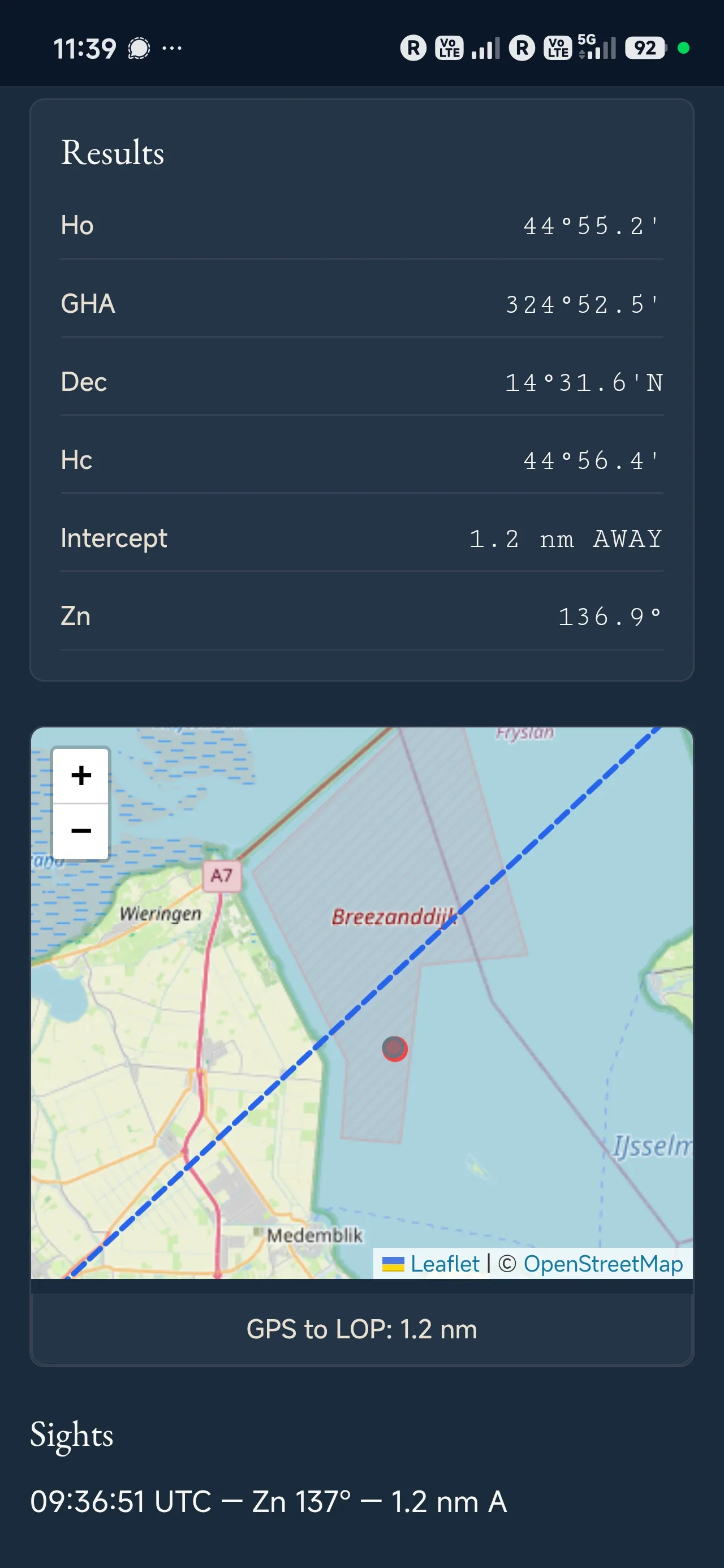
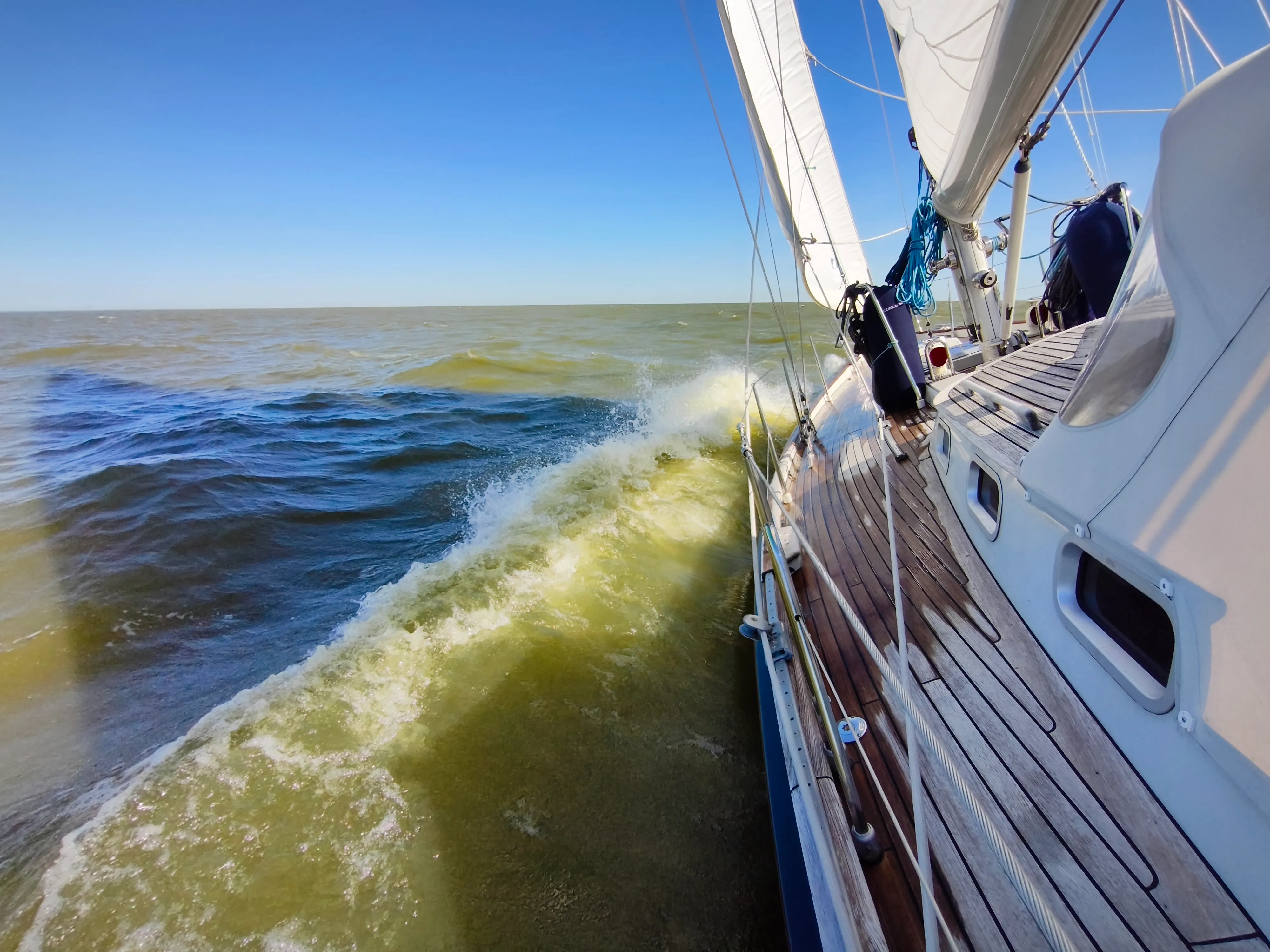


My first sight of the season went onto the screen at 09:36:51 UTC: a sextant altitude of 44°42.8’ from Coelacanth under sail. The resulting line of position fell 1.2 nautical miles from the GPS fix. Not bad for a first attempt, but there room to improve! The week was sunny thanks to a high-pressure system over the North Sea, but the easterly Beaufort 4 to 5 we were beating into kicked up the short steep chop the IJsselmeer is notorious for. Coelacanth’s cockpit is very steady and helps to get a reliable sight.
An experienced observer’s median sextant accuracy is around 0.7 nautical miles, with 95% of sights falling within 2 nm.3 Much of that error is systematic due to a consistent personal bias in how you read the horizon, time the sight, and handle the instrument. The only fix is to compare sextant position against a known reference, repeatedly, under real conditions. I clearly need more training!
After stops in Enkhuizen and Medemblik, where we spent the Koningsdag in the Oosterhaven, we hopped to Stavoren. The shallows off the harbour are the supposed setting of the legend of the Lady of Stavoren (“Frouke fan Starum” in Frisian), who threw a cargo of grain overboard out of pride and was ruined when the same grain washed back as a sandbank that closed her port. The motif is old: Herodotus tells it of Polycrates of Samos, who flings his ring into the sea to spoil his perfect run of luck and finds it again in the belly of a fish on his table. The tyrant Polycrates established a powerful navy and the first Greek maritime empire. He was ultimately lured to the mainland with promises of money (and by GPS jamming?) – and killed.
The kind lady harbourmaster of the Gemeentehaven pointed us to the wooden pier next to the fishing vessels. We watched the sun go down from the cockpit – wondering about the order of the universe.
Footnotes
- Blewitt M. Celestial Navigation for yachtsmen. Revised by Andy Du Port. Bloomsbury, London 2017.
- Marcq de Saint-Hilaire. Calcul du point observé : Méthode des hauteurs estimées et Point moyen donné par trois observations. Revue Maritime et Coloniale 1875;46:341-376, 714-742. The author had set out the same idea in shorter form two years earlier: Notes sur la détermination du point. Revue Maritime et Coloniale 1873;39:41-58. For a biographical sketch in English, see Mason WA. Marq Saint-Hilaire: Father of the New Navigation. U.S. Naval Institute Proceedings, August 1939;65(8).
- Malkin R. Understanding the accuracy of astro navigation. The Journal of Navigation 2014;67:63-81.